
Check out the great site from the Global Vegetation Project!
http://gveg.wyobiodiversity.org/index.php/explore-vegetation
 Mission:
The mission of the Global Vegetation Project is to inspire and empower people of all ages to learn about the diversity of vegetation on our planet and to provide educators with a resource for teaching online. We aim to bring the field into the classroom in a way that was previously impossible, enabling visual and interactive experiences that link vegetation and climate at the global scale.
Vision:
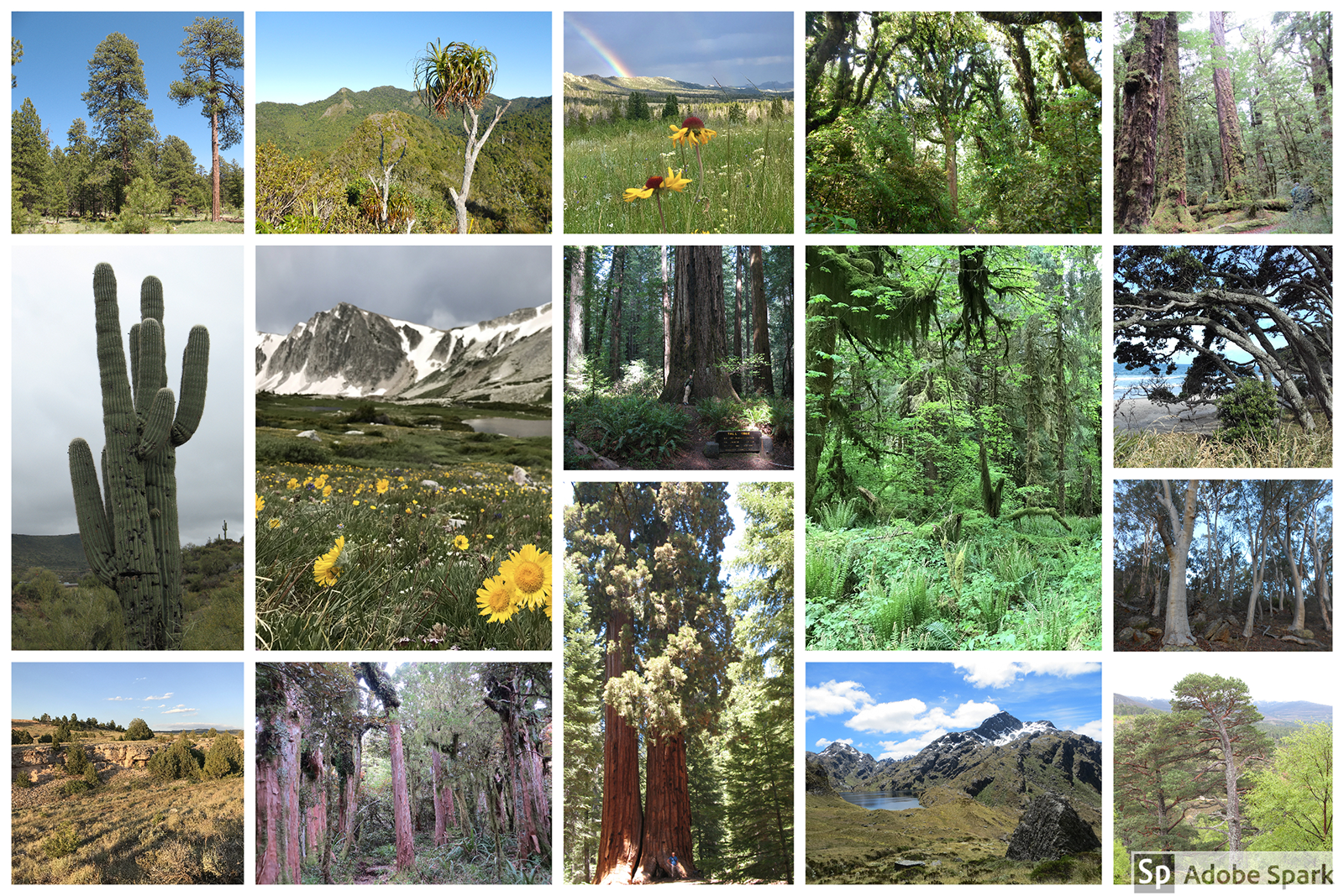
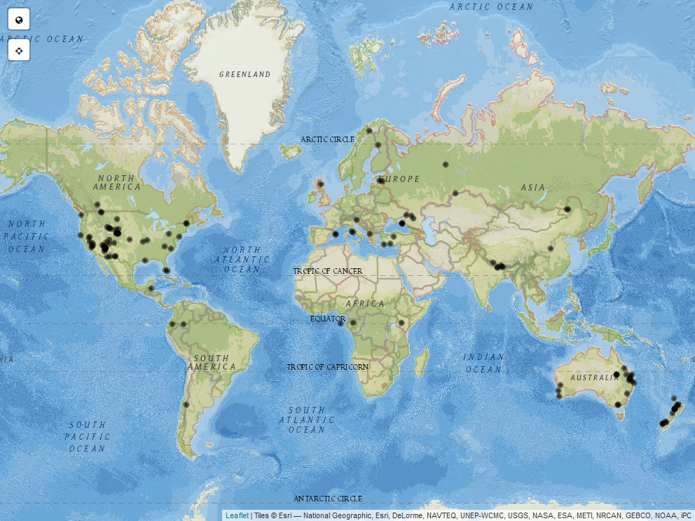
The long-term vision is to curate a database of vegetation photographs that can be explored interactively through an online interface. Anyone with an internet connection will be able to challenge themselves to tackle a variety of learning outcomes such as: 1) determining differences and similarities between vegetation types across the globe, 2) understanding how climate shapes vegetation, and 3) hypothesizing how climate change might affect the distribution of vegetation types in the future.This project was inspired both by the increased need for online field ecology teaching resources as well as the lack of a single e-repository with information on the diversity of vegetation types across the globe. The project is similar to iNaturalist but with a focus on communities of plants (i.e., vegetation) rather than individual species. With the help of user submitted photos, location information, and vegetation information, the Global Vegetation Project will create an interactive map where “travelers” can virtually navigate to points to explore vegetation types. Travelers can explore using a global map (see figure) or by using a Whittaker biome diagram (see figure) which illustrates how vegetation types relate to temperature and precipitation. Alternatively, vegetation can be viewed by filtering for specific regions, biomes, or presence of individual species.
The Global Vegetation Project is in development and you can help make it a success! Please submit your photos and information here to be included in the interactive map when it launches.
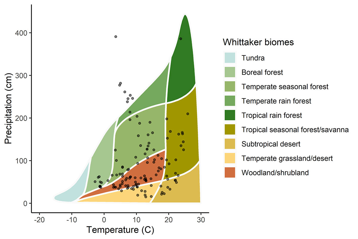
Our goal is to turn this graph black – (click to enlarge) to fill it with photo locations until you cannot even see the background! This illustrates the current distribution of photo points in relation to mean annual temperature and precipitation submitted to the Global Vegetation project prior to April 26