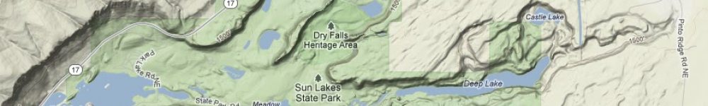
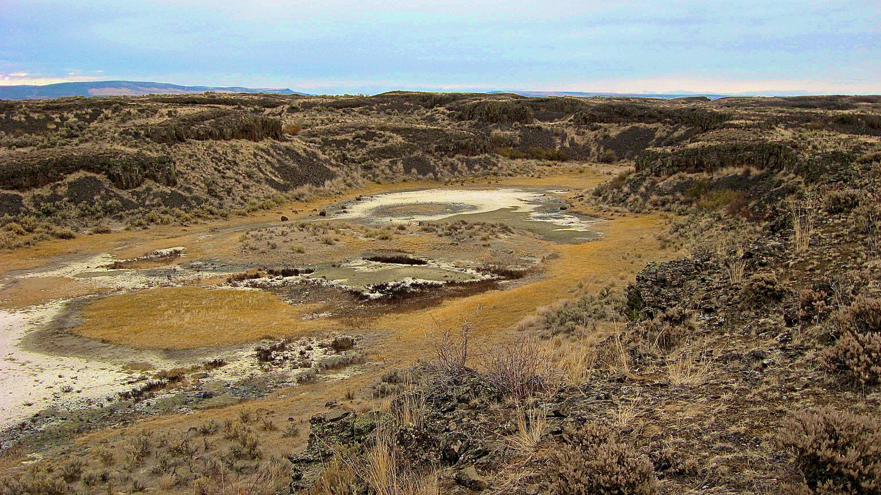
This is the Dry Gully. Dry Gully is about 2,755 feet from North to South, and is about 310 feet across. Talus slopes seem to surround the gully almost completely, except for the South East corner. The basin can be broken up into four areas, dried wetland, the talus slopes, the outlet out of the basin, and dry land. The dried wet land is characterized by the alkali dirt that has dried up at the bottom of the basin. The wet land has become so dry that all of what use to be mud has lost its moisture and started to crack. The talus slope area is surrounding the edge of the gully. Over time the basalt rocks have fallen from the cliffs, and made the edges of the gully slope into the basin. In the area that does not have talus slopes cascading into the basin, there is a large grouping of sagebrush. This area is much like the dry land. The dry land is anywhere that does not have dried alkali, or basalt rocks. On the dry land many shrubs and grasses grow.